A microsector is a division of a Grid Sector.
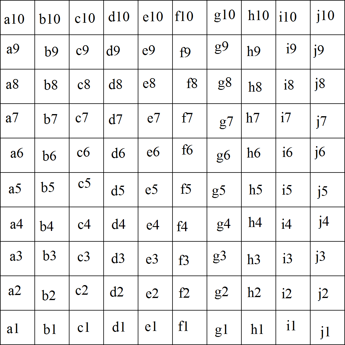
Microsectors inside a grid sector
Definition[]
A microsector is a square covering the surface of 100 sims (10 on a row from East to West and 10 on a row from South to North). Borders of every microsector are defined by Coordinates.
Every grid sector covers an area of 100 sims latitude and 100 sims longitude. Every microsector is made of 10 sims latitude and 10 sims longitude. So, every grid sector is divided in 100 microsectors (a row of 10 from East to West and a row of 10 from South to North).
Naming[]
The naming principle is inspired from that of a chess board (also used by many maps), by using combinations of letters and numbers.
Every grid sector is named with a capital letter and a number (see List Of Grid Sectors for details). A similar principle is used for microsectors. To make a visible difference, microsectors are named by using small letters (like a5 or f3). The letter indicate microsector's position from East to West, while the number indicate position from South to North. Letters can vary from a to j, while numbers vary from 1 to 10.
One can see that microsectors found on the same position inside every grid sector share the same name. This is true. To avoid confusions, it is good to refer to a microsector as related to its hosting grid sector (for example, grid sector H7, microsector c9). In order to locate a microsector faster, it is useful to also note the sim located to South-West corner (bottom left) or the nearest sim. Sometimes, another sim, more important or more known, can be used.
Example: J9, b1 - Argabuthon.
Structure[]
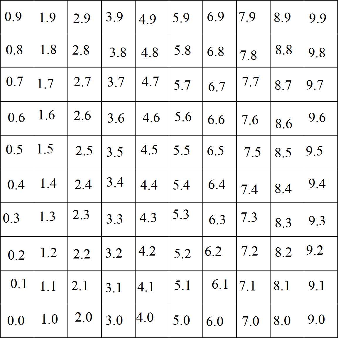
Sims inside a microsector
A microsector covers an area of 100 sims (10 on latitude and 10 on longitude). In some parts of the map (usually inside mainland continents), you can find full microsectors, where there is no empty sim, while in other parts of the map, there can be find a completely void microsector.
Sims inside a microsector are defined by numbers. The main difference is that numbering starts from 0 and ends at 9. The first number indicates latitude and the second, longitude. This way, the sim located at the South-West corner is named 0.0 or 0/0, while the sim located at the North-East corner is 9.9 or 9/9.
By using this system, Achemon sim, the home of SLGI team, is located inside grid sector J10, microsector a2, sim 4/8.
Reason[]
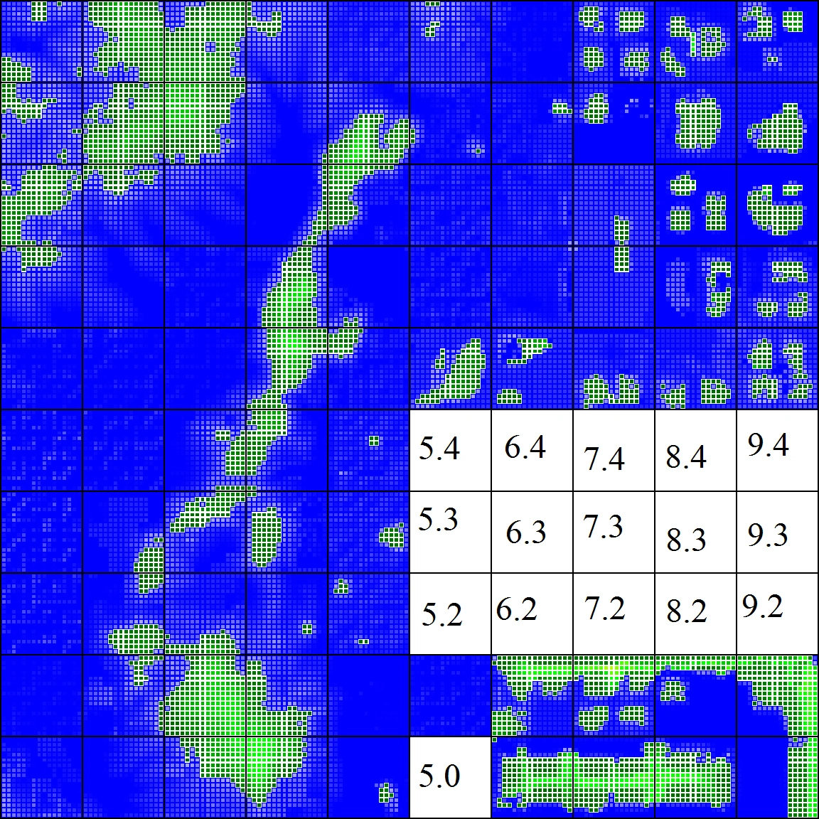
Altitude map for microsector K10 - d7
The microsector is a term invented by SLGI team. It might be useful for orientation purposes, but it is most used for mapping. In order to create detailed maps of a large continent, researchers can focus on a limited part of the map.
The example to the right is an altitude map created for a microsector inside Nautilus continent, that also reveals a tiny part of Seychelles Subcontinent. Tiny maps like this one are created for large mainland continents and sometimes for private-owned continents. Each map is created with the help of an avatar or a drone equipped with an altitude scanner.
There are many research projects that require the use of microsectors, like land structure (protected land, abandoned land and inhabited land), traffic (lag meters and avatar population), as well as creation of high-detailed maps.
Using microsectors is vital for Altitude maps.